
Idaho's Ashton-to-Tetonia Trail: Gravel Riding Beneath the Teton Range
Ashton
Ashton-to-Tetonia Trail
Distance: 30 Miles
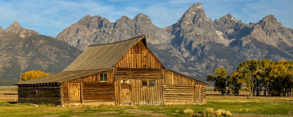
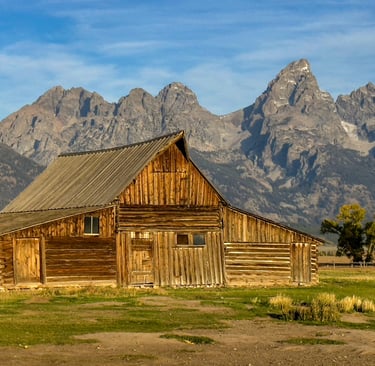
The Ashton-to-Tetonia Trail runs just under 30 miles across eastern Idaho, following a former Union Pacific rail corridor from Ashton to the small town of Tetonia. Much of the route is gravel, with sections of packed dirt and the occasional rougher stretch, giving it a more textured feel than a paved rail-trail. What sets this ride apart is the combination of steady grades, wide-open farmland, and a skyline dominated by the Teton Range. The mountains come into view early in the ride and grow steadily larger as you head east, creating a sense of movement toward the peaks even though the trail itself stays on gentle terrain.
Cycling From Ashton to the Bridges and Farms
The trail begins on the west end in Ashton, where the grade is slight and the surface firm. Early miles roll through open fields lined with irrigation pivots, silos, and long views across agricultural country. The surface shifts between well-packed gravel and slightly looser sections, but the consistency is good enough to hold a steady pace.
A few miles in, the first major landmark appears: the historic Conant Creek Pegram Truss Railroad Bridge. This steel span, built in the 1890s, arcs over the canyon with a wide wooden deck now suited for riders. It’s one of the most distinctive structures on any rail-trail in the region.
Beyond Ashton, the countryside widens and the Tetons begin draw your attention. The trail remains straight for long stretches. Near Marysville and Lamont, the landscape shifts subtly — meadows thicken, cottonwoods appear along the water, and the trail edges closer to the foothills. As you approach Bitch Creek, the terrain rolls slightly, and the crossing offers a quieter, more shaded break from the open farmland.
Closing In on the Tetons
Past the creek crossings, the route rises gently toward Tetonia, and this final section delivers the biggest views. The Grand, Middle, and South Teton dominate the horizon, framed by pastureland and lodgepole stands. Even on hazy days, the outline of the peaks gives the eastern half of the ride a sense of awe. Parking areas at Lamont and Felt provide access points, but services are minimal.
The gravel surface is one of the trail’s main assets and also its biggest caveat. After rain, the surface can run soft, making progress slower. Washboard patches appear in dry conditions, and some sections can feel exposed in hot weather due to limited shade. Despite these drawbacks, the route is generally well maintained, with clear signage at road crossings and a consistent grade that keeps the effort moderate. The remoteness between towns means preparation matters — once you leave Ashton or Tetonia, you’re largely on your own until the next trailhead.
From wide plains to river bridges to the steady approach toward the Tetons, the Ashton-to-Tetonia Trail offers a nice mix of scenery and gravel riding without technical demands. It’s a straightforward, rewarding route that puts Idaho’s eastern landscapes on full display.
Cycling in Idaho: The pull of the Tetons


Dress for those chilly rides with this popular base layer.
Ashton-to-Tetonia Trail
Distance: 30 Miles
The Ashton-to-Tetonia Trail runs just under 30 miles across eastern Idaho, following a former Union Pacific rail corridor from Ashton to the small town of Tetonia. Much of the route is gravel, with sections of packed dirt and the occasional rougher stretch, giving it a more textured feel than a paved rail-trail. What sets this ride apart is the combination of steady grades, wide-open farmland, and a skyline dominated by the Teton Range. The mountains come into view early in the ride and grow steadily larger as you head east, creating a sense of movement toward the peaks even though the trail itself stays on gentle terrain.
Cycling From Ashton to the Bridges and Farms
The trail begins on the west end in Ashton, where the grade is slight and the surface firm. Early miles roll through open fields lined with irrigation pivots, silos, and long views across agricultural country. The surface shifts between well-packed gravel and slightly looser sections, but the consistency is good enough to hold a steady pace.
A few miles in, the first major landmark appears: the historic Conant Creek Pegram Truss Railroad Bridge. This steel span, built in the 1890s, arcs over the canyon with a wide wooden deck now suited for riders. It’s one of the most distinctive structures on any rail-trail in the region.
Beyond Ashton, the countryside widens and the Tetons begin draw your attention. The trail remains straight for long stretches. Near Marysville and Lamont, the landscape shifts subtly — meadows thicken, cottonwoods appear along the water, and the trail edges closer to the foothills. As you approach Bitch Creek, the terrain rolls slightly, and the crossing offers a quieter, more shaded break from the open farmland.
Closing In on the Tetons
Past the creek crossings, the route rises gently toward Tetonia, and this final section delivers the biggest views. The Grand, Middle, and South Teton dominate the horizon, framed by pastureland and lodgepole stands. Even on hazy days, the outline of the peaks gives the eastern half of the ride a sense of awe. Parking areas at Lamont and Felt provide access points, but services are minimal.
The gravel surface is one of the trail’s main assets and also its biggest caveat. After rain, the surface can run soft, making progress slower. Washboard patches appear in dry conditions, and some sections can feel exposed in hot weather due to limited shade. Despite these drawbacks, the route is generally well maintained, with clear signage at road crossings and a consistent grade that keeps the effort moderate. The remoteness between towns means preparation matters — once you leave Ashton or Tetonia, you’re largely on your own until the next trailhead.
From wide plains to river bridges to the steady approach toward the Tetons, the Ashton-to-Tetonia Trail offers a nice mix of scenery and gravel riding without technical demands. It’s a straightforward, rewarding route that puts Idaho’s eastern landscapes on full display.
Cycling in Idaho: The pull of the Tetons
Dress for those chilly rides with this popular base layer.
Some pages contain affiliate links. If you purchase something through one of these links, we may earn a small commission.