
Mountains to Desert Along the Tahoe-Pyramid Trail
Tahoe City, California to Pyramid Lake, Nevada
Tahoe-Pyramid Trail
Distance: 114 miles
The Tahoe–Pyramid Trail runs 114 miles from the high country of Lake Tahoe to Pyramid Lake in Nevada, following the Truckee River corridor as it winds through canyons, farmland, and old railroad corridors. It’s a route that feels like several rides in one — alpine air at the start, desert heat at the finish, with a mix of paved path and gravel stretches connecting the two. Riders should note that as of late 2025, some sections were still under development.
Cycling in California: Changing scenery and trail conditions
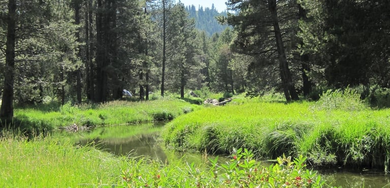
Starting in California, the first miles trace the lake before dropping into forested sections above the Truckee River. The air is cool and thin, and the trail alternates between paved multi-use path and compacted dirt. Riders soon reach Truckee, a mountain town where you find coffee shops and bike stores that line the main street, while the river rushes below bridges that once carried logging trains.
Beyond Truckee, the trail begins to descend. The Truckee River Canyon section, running toward Verdi and Reno, delivers some of the best scenery on the route. Granite walls rise beside the water, and stretches of open trail run close to the current, giving long views of rapids and pines. Between Floriston and Verdi, the route occasionally merges with frontage roads before rejoining quieter paths closer to Reno.
Reno marks the midpoint and transition zone — from mountain to desert. Within the city, the trail follows a well-built riverwalk with shaded benches, bridges, and easy access to restaurants and lodging. It’s a good place to stop, resupply, or split the ride over two days. East of Reno, the landscape changes fast: trees fade, sagebrush takes over, and the horizon stretches out.
Plan for remote riding
The route beyond Sparks toward Wadsworth and Fernley is more remote. Long, straight segments run through open desert with few services, and wind is often a factor. Riders who take on this section usually plan carefully, carrying plenty of water and spare tubes. The Truckee River becomes a thinner thread through this country, but the views are vast and unbroken.
The trail surface is a mix — paved through Tahoe City, Truckee, and most of Reno, with packed dirt and gravel between towns. It’s suitable for gravel or touring bikes with medium-width tires, and signage improves every year as new sections are completed. The elevation loss from Tahoe to the plains makes the west-to-east direction slightly easier, though strong winds can reverse that advantage.
Weather is the biggest variable. Snow lingers near Tahoe into early summer, and daytime heat in the lower desert can push well past 90 degrees by July. Autumn brings the best balance of temperature and visibility, with clear skies and fewer riders.
The Tahoe–Pyramid Trail is one of the most ambitious long-distance routes in the West — not just for its scenery, but for the way it connects mountain forest to open desert in a single continuous ride. From the alpine shade of Tahoe City to the sagebrush flats beyond Fernley, it’s a cross-section of Nevada and the Sierra that shows just how much the landscape can change in a single day on two wheels.


No weather worries with these waterproof panniers!
Lush scenery along the Tahoe-Pyramid cycling trail
Tahoe-Pyramid Trail
Distance: 114 miles
The Tahoe–Pyramid Trail runs 114 miles from the high country of Lake Tahoe to Pyramid Lake in Nevada, following the Truckee River corridor as it winds through canyons, farmland, and old railroad corridors. It’s a route that feels like several rides in one — alpine air at the start, desert heat at the finish, with a mix of paved path and gravel stretches connecting the two. Riders should note that as of late 2025, some sections were still under development.
Cycling in California: Changing scenery and trail conditions
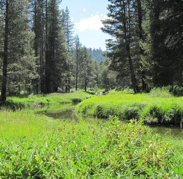
Starting in California, the first miles trace the lake before dropping into forested sections above the Truckee River. The air is cool and thin, and the trail alternates between paved multi-use path and compacted dirt. Riders soon reach Truckee, a mountain town where you find coffee shops and bike stores that line the main street, while the river rushes below bridges that once carried logging trains.
Beyond Truckee, the trail begins to descend. The Truckee River Canyon section, running toward Verdi and Reno, delivers some of the best scenery on the route. Granite walls rise beside the water, and stretches of open trail run close to the current, giving long views of rapids and pines. Between Floriston and Verdi, the route occasionally merges with frontage roads before rejoining quieter paths closer to Reno.
Reno marks the midpoint and transition zone — from mountain to desert. Within the city, the trail follows a well-built riverwalk with shaded benches, bridges, and easy access to restaurants and lodging. It’s a good place to stop, resupply, or split the ride over two days. East of Reno, the landscape changes fast: trees fade, sagebrush takes over, and the horizon stretches out.
Plan for remote riding
The route beyond Sparks toward Wadsworth and Fernley is more remote. Long, straight segments run through open desert with few services, and wind is often a factor. Riders who take on this section usually plan carefully, carrying plenty of water and spare tubes. The Truckee River becomes a thinner thread through this country, but the views are vast and unbroken.
The trail surface is a mix — paved through Tahoe City, Truckee, and most of Reno, with packed dirt and gravel between towns. It’s suitable for gravel or touring bikes with medium-width tires, and signage improves every year as new sections are completed. The elevation loss from Tahoe to the plains makes the west-to-east direction slightly easier, though strong winds can reverse that advantage.
Weather is the biggest variable. Snow lingers near Tahoe into early summer, and daytime heat in the lower desert can push well past 90 degrees by July. Autumn brings the best balance of temperature and visibility, with clear skies and fewer riders.
The Tahoe–Pyramid Trail is one of the most ambitious long-distance routes in the West — not just for its scenery, but for the way it connects mountain forest to open desert in a single continuous ride. From the alpine shade of Tahoe City to the sagebrush flats beyond Fernley, it’s a cross-section of Nevada and the Sierra that shows just how much the landscape can change in a single day on two wheels.
Lush scenery along the Tahoe-Pyramid cycling trail
Some pages contain affiliate links. If you purchase something through one of these links, we may earn a small commission.