
Michigan's Cross-State Behemoth - The Iron Belle Trail
Iron Belle Trail
Distance: 828 miles total (Flat Rock – 43 miles)
Michigan’s Iron Belle Trail is about as ambitious as bike routes get. Stretching close to 828 miles from Ironwood in the Upper Peninsula all the way to Belle Isle in Detroit, it’s a project that aims to tie the whole state together. Some sections are already in place and rideable, others are still under construction or rely on road connections, but taken together it’s Michigan’s big swing at a signature, cross-state ride.
One of the easiest ways to make sense of it right now is through mapped chunks on Ride With GPS. For example, there’s a segment around Flat Rock that shows how the Iron Belle mixes suburban paths, riverside trails, and stretches of quiet roadway. You can check out the route here: Iron Belle Trail, Flat Rock, MI — Ride With GPS. It’s a good preview of what the trail feels like in areas where it’s stitched together from different types of riding surfaces.
A trail of many surfaces
Don’t expect one long, uninterrupted ribbon of pavement. The Iron Belle is more like a chain of existing trails and low-traffic roads linked together. In one stretch you might be on a smooth, wide asphalt path through a park, and then a mile later you’re rolling along the shoulder of a residential street. In other words, it’s not a “set it and forget it” kind of ride. Be aware that there are transitions.
Downstate, you’ll pass rivers, small towns, and pockets of suburban sprawl. As you head north, the ride becomes more rural, with open farmland, stretches of forest, and lakeshores that remind you why Michigan calls itself the Great Lakes State. Some of the most established pieces, like the nine-mile Paint Creek Trail or the 62-mile North Central State Trail, show off the best of that Midwestern mix—quiet woods, open skies, and towns where you can grab a coffee or lunch before rolling on.
Plan on stretches with no amenities
Amenities come and go. In the more built-up sections, bathrooms, food, and even bike shops are easy to find. But on rural stretches, you’re on your own for long miles. Planning matters. Riders tackling longer portions should carry plenty of water and snacks and be ready for stretches without services.
The Iron Belle does have its rough edges. First and most obvious, it isn’t fully finished. That means detours, road riding, and in some spots, signage that leaves you scratching your head. Surfaces also vary—what looks smooth and paved on a map might turn into packed gravel, or a stretch of shoulder along a two-lane highway. And depending on the season, you can run into flooding, fallen branches, or overgrowth.
Still, even with those bumps, this Michigan bike trail has a lot going for it. For one, the scale is huge. Eight hundred twenty-eight miles is enough to keep even long-distance riders busy for weeks or years, whether you want to tackle it all in a thru-ride or break it into chunks. For another, it’s one of the few projects in the country that really tries to stitch together so many different regions into a single, coherent route.
Start with a mapped section like Flat Rock, get a feel for how the route works, and then set your sights on tackling more. It may not be finished yet, but it’s already a ride that tells a story of a whole state.
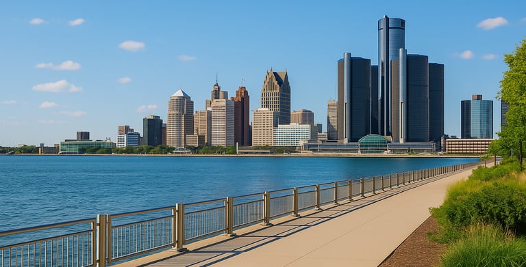
Cycling in Michigan: The Iron Belle Trail near Detroit (AI Image)


Find a great Michigan cycling jersey here!
Iron Belle Trail
Distance: 828 miles total (Flat Rock – 43 miles)
Michigan’s Iron Belle Trail is about as ambitious as bike routes get. Stretching close to 828 miles from Ironwood in the Upper Peninsula all the way to Belle Isle in Detroit, it’s a project that aims to tie the whole state together. Some sections are already in place and rideable, others are still under construction or rely on road connections, but taken together it’s Michigan’s big swing at a signature, cross-state ride.
One of the easiest ways to make sense of it right now is through mapped chunks on Ride With GPS. For example, there’s a segment around Flat Rock that shows how the Iron Belle mixes suburban paths, riverside trails, and stretches of quiet roadway. You can check out the route here: Iron Belle Trail, Flat Rock, MI — Ride With GPS. It’s a good preview of what the trail feels like in areas where it’s stitched together from different types of riding surfaces.
A trail of many surfaces
Don’t expect one long, uninterrupted ribbon of pavement. The Iron Belle is more like a chain of existing trails and low-traffic roads linked together. In one stretch you might be on a smooth, wide asphalt path through a park, and then a mile later you’re rolling along the shoulder of a residential street. In other words, it’s not a “set it and forget it” kind of ride. Be aware that there are transitions.
Downstate, you’ll pass rivers, small towns, and pockets of suburban sprawl. As you head north, the ride becomes more rural, with open farmland, stretches of forest, and lakeshores that remind you why Michigan calls itself the Great Lakes State. Some of the most established pieces, like the nine-mile Paint Creek Trail or the 62-mile North Central State Trail, show off the best of that Midwestern mix—quiet woods, open skies, and towns where you can grab a coffee or lunch before rolling on.
Plan on stretches with no amenities
Amenities come and go. In the more built-up sections, bathrooms, food, and even bike shops are easy to find. But on rural stretches, you’re on your own for long miles. Planning matters. Riders tackling longer portions should carry plenty of water and snacks and be ready for stretches without services.
The Iron Belle does have its rough edges. First and most obvious, it isn’t fully finished. That means detours, road riding, and in some spots, signage that leaves you scratching your head. Surfaces also vary—what looks smooth and paved on a map might turn into packed gravel, or a stretch of shoulder along a two-lane highway. And depending on the season, you can run into flooding, fallen branches, or overgrowth.
Still, even with those bumps, this Michigan bike trail has a lot going for it. For one, the scale is huge. Eight hundred twenty-eight miles is enough to keep even long-distance riders busy for weeks or years, whether you want to tackle it all in a thru-ride or break it into chunks. For another, it’s one of the few projects in the country that really tries to stitch together so many different regions into a single, coherent route.
Start with a mapped section like Flat Rock, get a feel for how the route works, and then set your sights on tackling more. It may not be finished yet, but it’s already a ride that tells a story of a whole state.
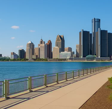
Cycling in Michigan: The Iron Belle Trail near Detroit (AI Image)
Find a great Michigan cycling jersey here!
Some pages contain affiliate links. If you purchase something through one of these links, we may earn a small commission.